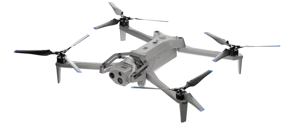
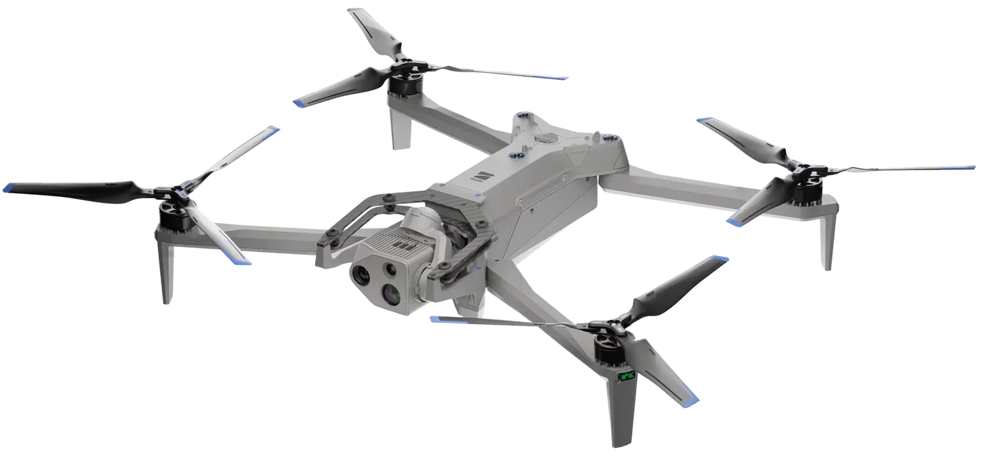
Skydio X10D
A compact sUAS engineered for EW resilience and survivability in the world’s most contested battlefields. Dual-use innovation brings best-in-class sensors to this class of drone, powered by advanced AI and built to scale.
20 m/s
Max flight speed
>40 sec
Deployment time
IP55
Certified against dust and water
2.49 kg
Max takeoff weight
40 min
Max flight time
12 km
Wireless range
Resilient and survivable under electronic warfare pressure
Achieve mission success with the ability to:
- Dynamically switch channels using a powerful multiband radio to sustain communications in contested spectrum environments
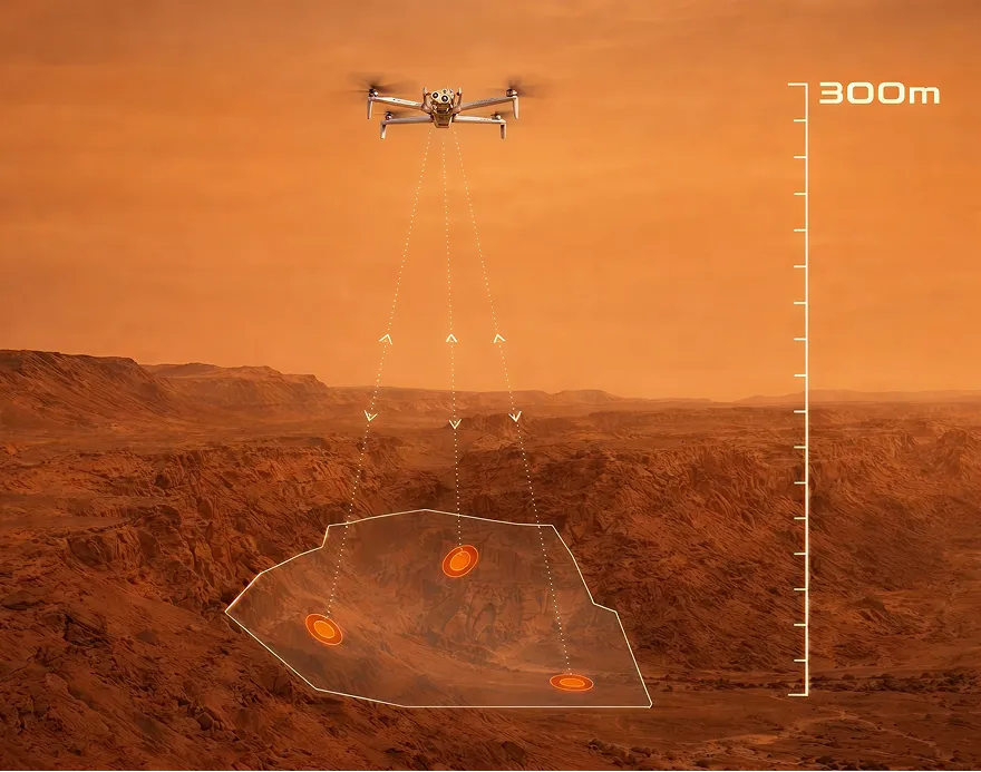
- Increase survivability in GNSS-denied or spoofed conditions with high-altitude Visual Inertial Odometry (VIO), operating at elevations of several kilometers
- Navigate and return autonomously without GPS using Anchor Points, leveraging vision-based reference placement directly on the map
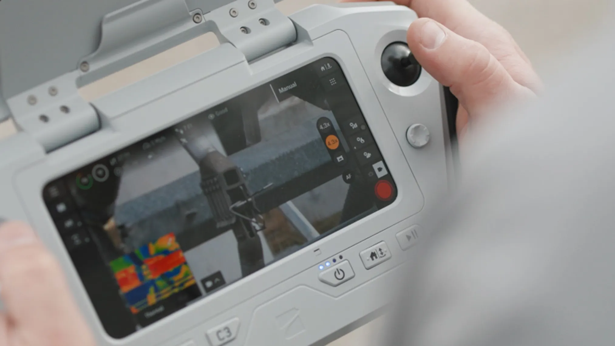
Next-generation vision for demanding missions
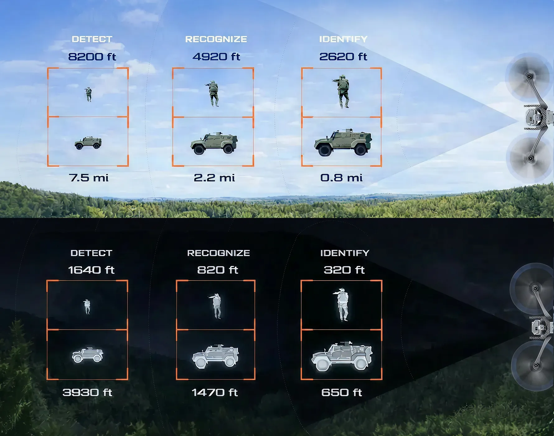
AI at the core. Redefining mission performance.
Specification
Startup time
Under 40 seconds
Dimensions (unfolded, with propellers)
31.1” x 25.6” x 5.7” / 79.0 cm × 65.0 cm × 14.5 cm.
Dimensions (folded, without battery)
13.8” x 6.5” x 4.7” / 35.05 cm x 16.51 cm x 11.94 cm
Weight (incl. batteries)
Connect SL: 4.65lbs / 2.11kg
Connect MH: 4.72lbs / 2.14kg
Max takeoff weight
5.49 lbs / 2.49 kg
Operation frequency
Connect SL: 5180-5825Mhz
Connect MH:
1790-1850MHz
2040-2110MHz
2200-2300MHz
2300-2390MHz
2400-2500MHz
Transmitter power (EIRP)
Connect SL: 34.3dBmi (2.4GHZ)
Connect MH: 38dBmi
Hovering accuracy (windless or breezy)
VIO: ± 10cm
GNSS: ± 1m
Max angular velocity
Yaw: 100° deg/s
Roll / pitch: 225° deg/s
Max tilt angle
40°
Max ascent/decent speed
Ascent: 13.4mph / 6 m/s
Descent: 9.0mph / 4 m/s
Max non-vertical descent speed
13.4mph / 6 m/s
Max horizontal speed (at sea level)
45mph / 20 m/s
Max horizontal speed with obstacle avoidance
36mph / 16 m/s
Max service ceiling above sea level (without other payload)
15,000' / 4,572m density altitude
Max gust handling
At or under 28 mph / 12.8 m/s
Max hover time
35 minutes
Max flight time*
40 minutes
Processors
NVIDIA Jetson Orin SoC
Qualcomm QRB5165 SoC
Ingress protection rating
IP55
GNSS
GPS + Galileo + GLONASS + BeiDou
Geofence limitations
No
Operational temperature range
-4°F to 113°F / -20°C to +45°C
Wireless range (no interference, line of sight operation)
Connect SL: 12km / 7.5 miles
Connect MH: 10km / 6.2 miles
Wireless networking (media offload)
N/A
Obstacle avoidance coverage
True 360°
Want to have a test flight?
See how advanced AI, resilient connectivity, and mission-ready sensors perform in real-world conditions.