Do more. Risk less.
We deliver cutting-edge unmanned systems for real-world missions.


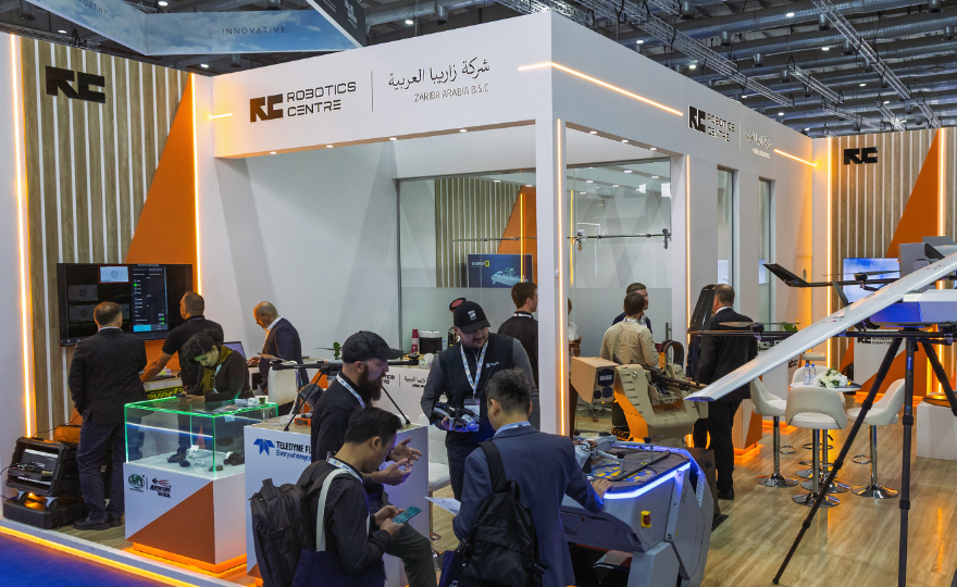
We are Robotics
Uncrewed systems and technologies are reshaping our understanding of security. We know which systems deliver the highest efficiency, which ones truly matter today, and how to combine them to achieve the best possible outcome.
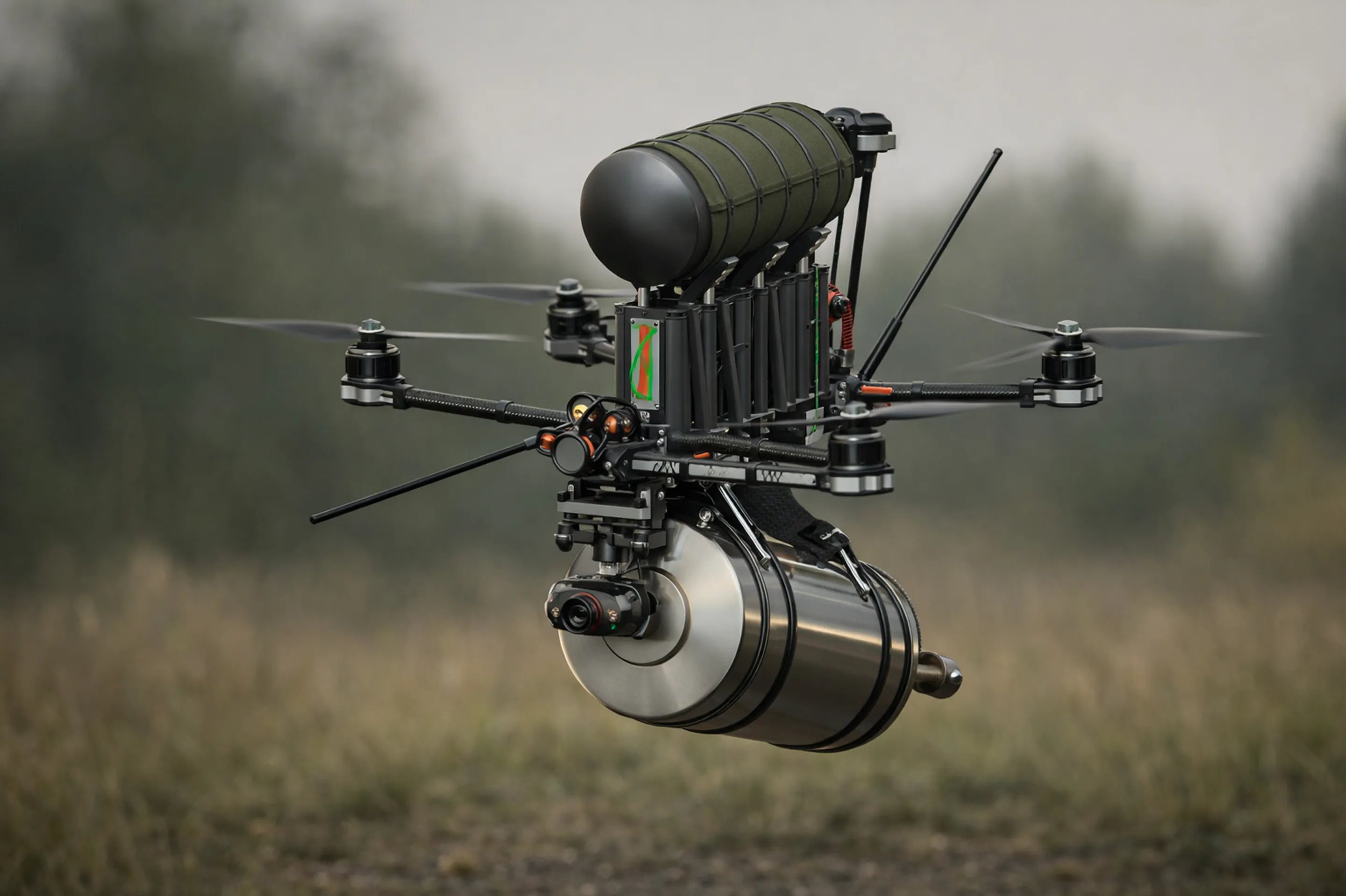
Shuriken
Customizable, Canadian-made family of FPV drones. Ready for mission use within minutes
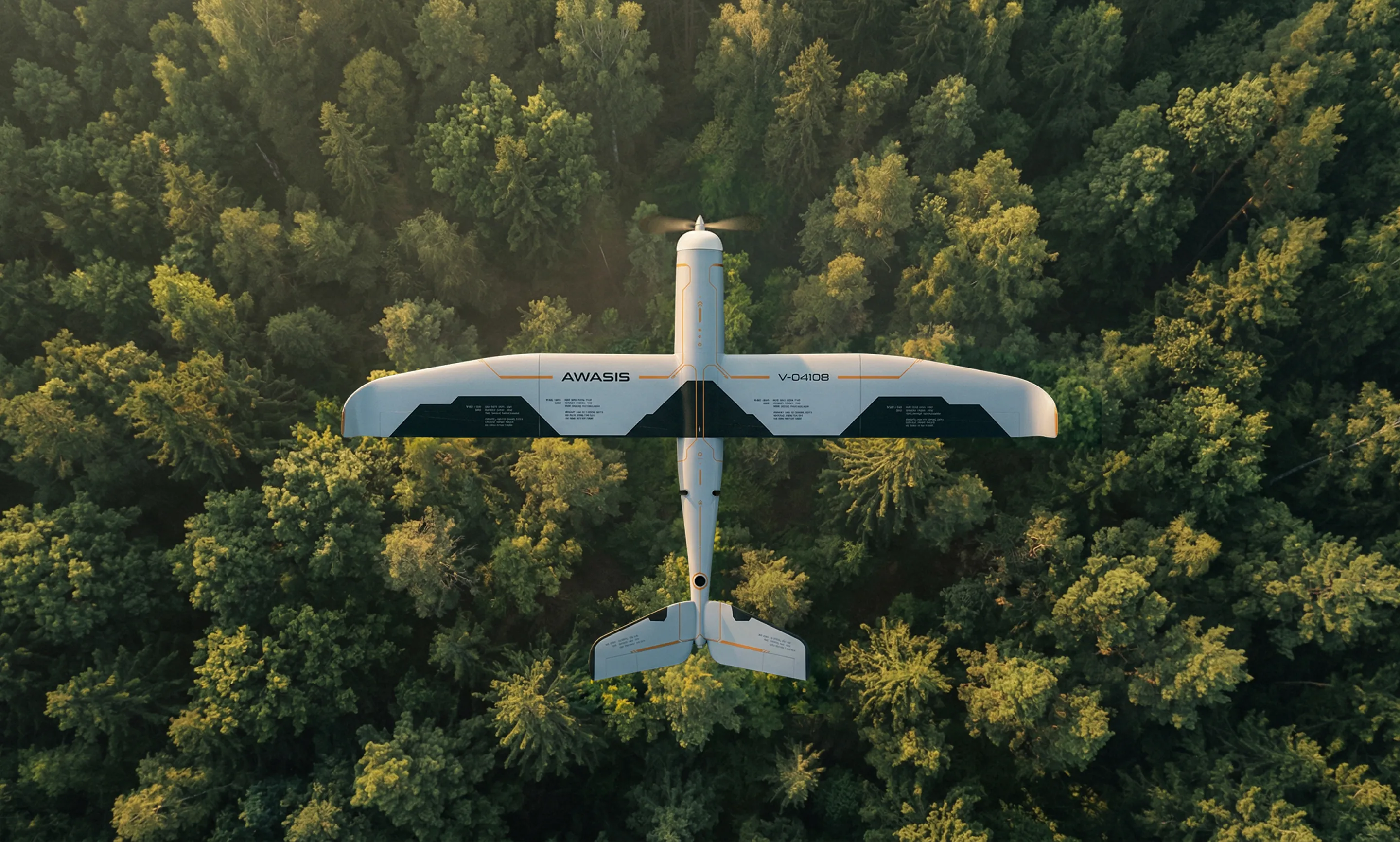
Awasis
based on Ukrainian UAV and improved for cold environment
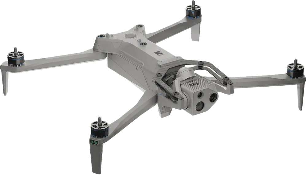
Skydio X10D
Cutting-edge American-made short-range ISR quad drones for military & first responders
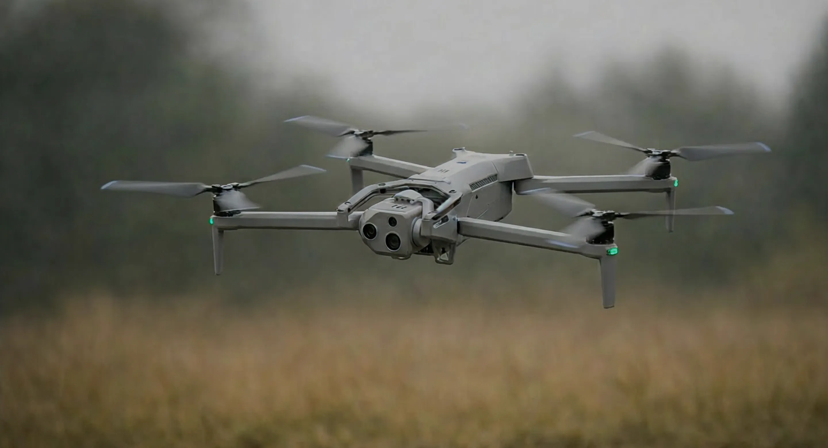
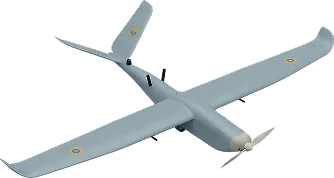
Awasis
Forged in Ukraine & made in Canada, Awasis is a battle-proven ISR drone ideal for tactical reconnaissance at distances up to 100 km
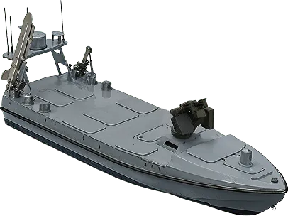
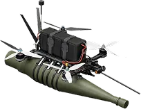
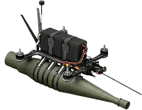
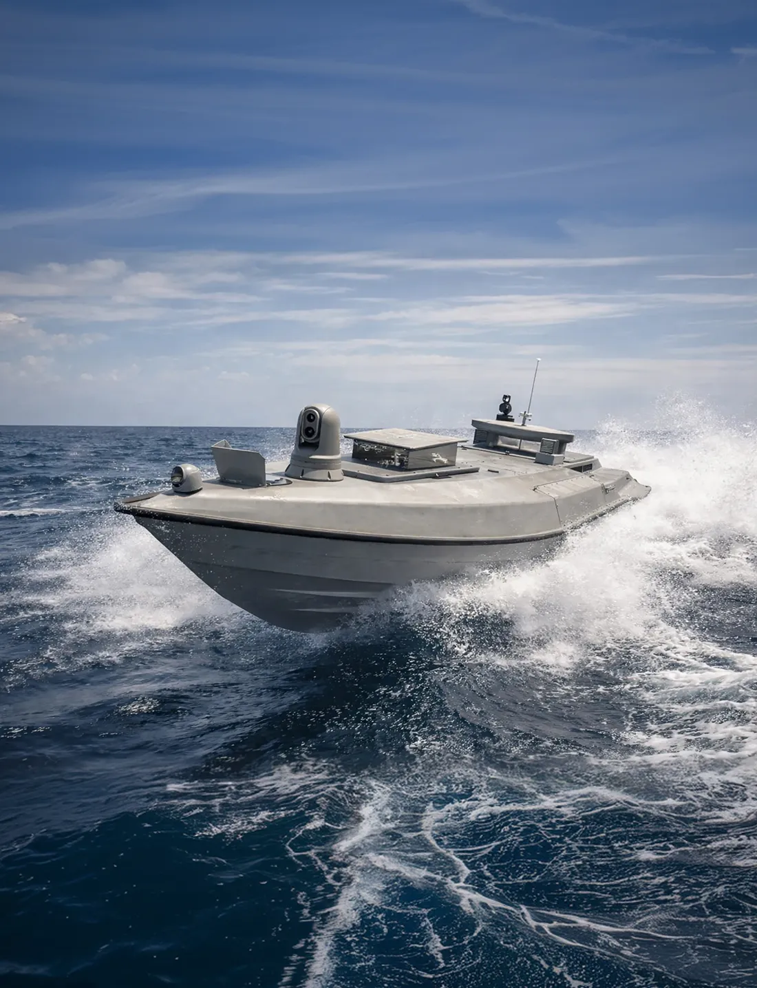
Iceheart
Forged in Ukraine & made in Canada to operate in the most extreme conditions, Iceheart is a battle-proven fast, stealthy, swarm-capable naval drone built for reconnaissance, patrolling, and strike missions.
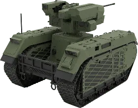
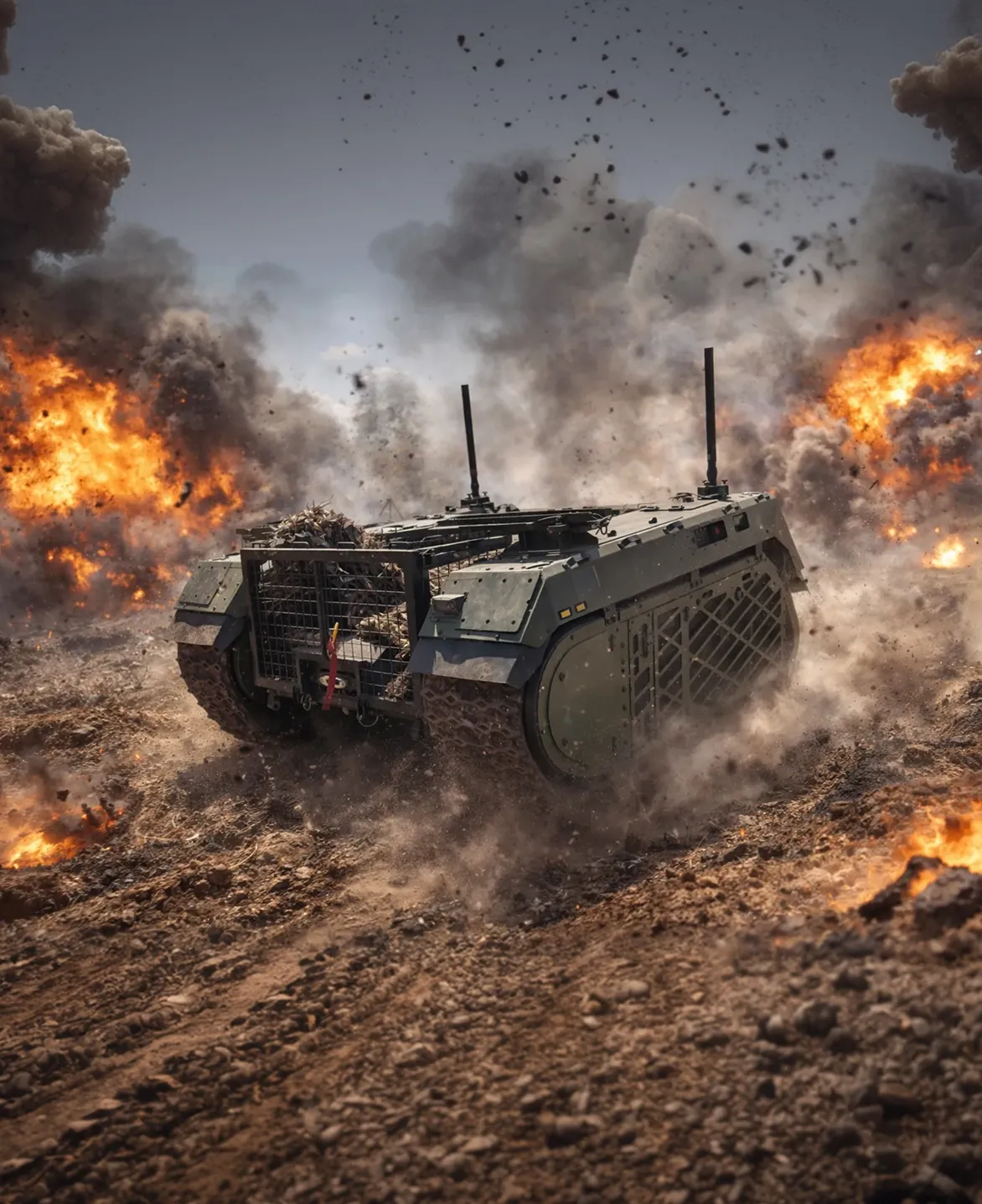
THeMIS
A flexible, battle-proven ground platform made in Estonia. Built for combat, reconnaissance, and logistics
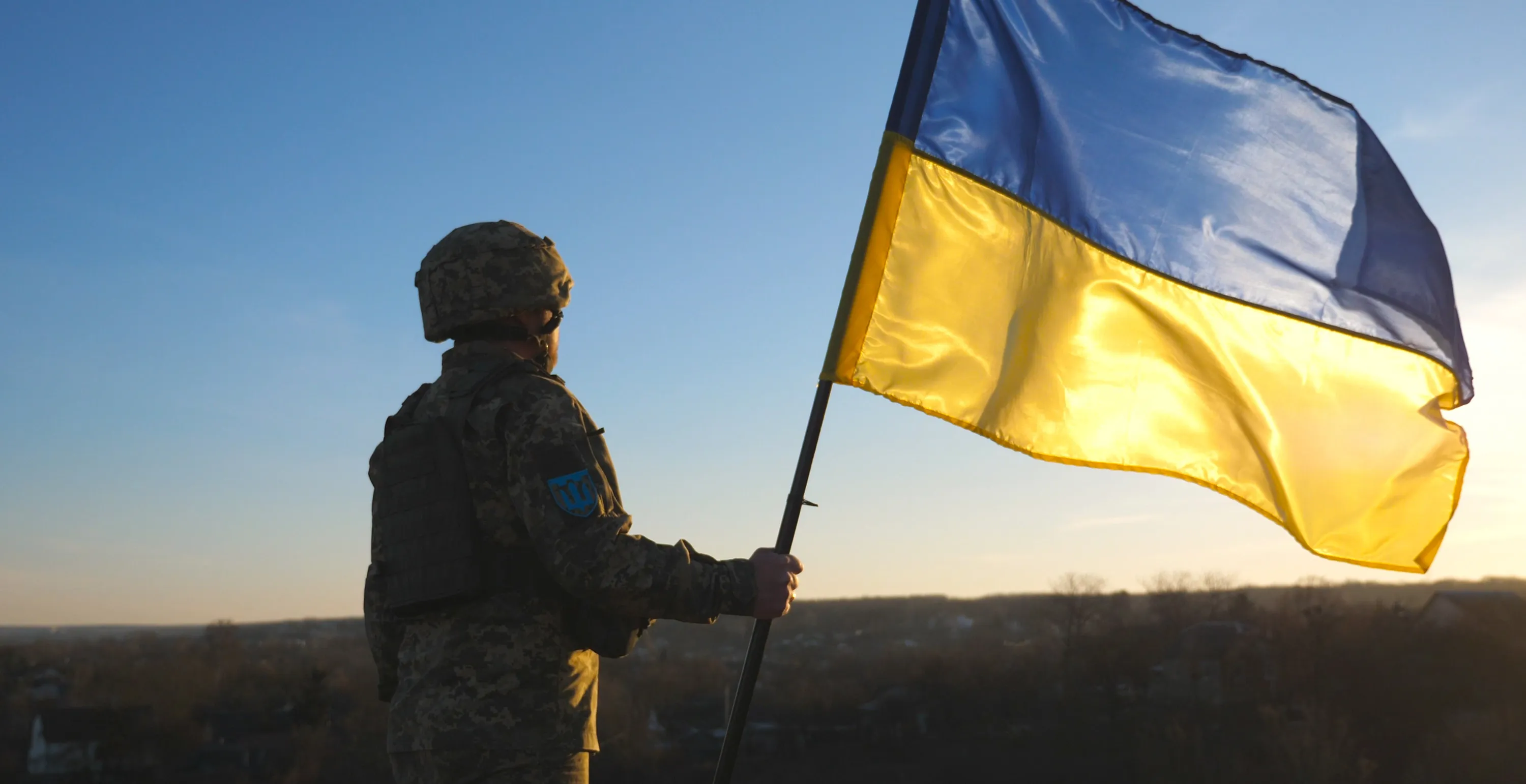
We stand with Ukraine
We work closely with the Ukrainian companies fielding the most effective unmanned systems on the battlefield today. We have established an office there and regularly send our people to Kyiv and their people to Ottawa. We exchange ideas, processes, and hardware. We have embraced the Ukrainian philosophy of success with unmanned systems — fielded at scale, produced as inexpensively as possible, and rapidly evolved according to end user requirements.
All of our business cards and brochures are now printed in Ukraine, and we are using Ukrainian companies to assist with marketing, design, and web support. Little things are important too.